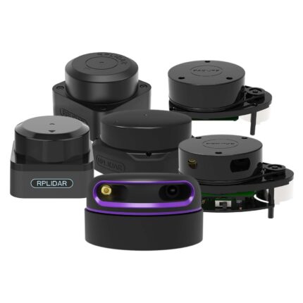
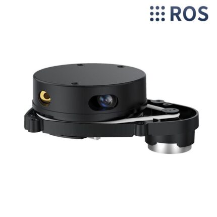
SLAMTEC Aurora Mapping & Localization

All-In-One SLAM Mapping LiDAR

Description

Description

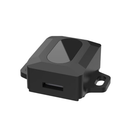
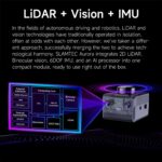
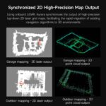
Aurora is an integrated positioning and mapping sensor that integrates LiDAR, binocular vision, inertial navigation (IMU) and AI deep learning technology, with highly integrated 3D perception capabilities. Aurora can achieve high-precision indoor and outdoor 3D mapping as soon as it is turned on, without external dependencies, supports 6 DOF positioning, and is suitable for a variety of scenarios, such as multi-story building mapping and large-scale space mapping. We provide detailed tutorial materials, including graphical interactive software RoboStudio and SDK for secondary development, can help users expand different application projects.

Features

1. Fusion of LiDAR + binocular vision + IMU multi-source fusion algorithm.

2. No need master control, it can complete indoor and outdoor 3D mapping and positioning functions. 

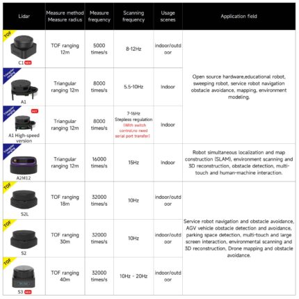
3. Mapping area can reach 100,0000m2, measurement distance up to 40M.

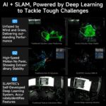
4. Integrates AI technology to improve 3D perception capabilities, maintaining stable mapping and positioning even in high-speed motion environments.

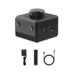
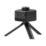
5. Comes with a handheld triangle bracket, which is convenient for users to completehandheld mapping or place it anywhere.


SLAMTEC Aurora with LiDAR and Binocular vision as well as IMU, 40 meter scanning distance and large mapping area.
SLAMTEC Aurora: LiDAR + binocular vision 3D 6DOF localization, AI deep learning, ROS/Android SDK, multi-platform, compact.

Aurora integrates laser + binocular vision + IMU multi-source fusion algorithm, plus AI support, ready to use out of the box
Aurora is the first in the industry to integrate AI and SLAM and effectively eliminate interference and stabilize positioning
Aurora has deep learning, can stably locate in high-speed motion, accurately extract features, and build a map framework
Aurora provides full range of 3D+6DOF positioning capabilities and can work immediately after power on, making it easy to use
SLAMTEC Aurora is specially designed for humanoid robots and multi-legged robot dogs to handle complex environments
SLAMTEC Aurora with deep learning and perform stable mapping and positioning in the dark and at high speed moving
SLAMTEC Aurora fully mapped the 47.7km inner ring road of Shanghai, with area of 120k㎡
SLAMTEC Aurora synchronously outputs 2D laser maps to achieve 3D point cloud high-precision maps
SLAMTEC Aurora is compact and easy to embed into large or small robotic devices
SLAMTEC Aurora is simple to install and easy to use: install, turn on and collect information
SLAMTEC Aurora with free mapping app to view visual features, scan results and save 2D maps
SLAMTEC Aurora has strong compatibility and is fit to Raspberry Pi, NVIDIA Jetson, RDK series development boards and robots
SLAMTEC Aurora supports ROS1, ROS2 and provides their SDK and related materials
Users can use SLAMTEC Aurora through ROS1and ROS2 SDK to quickly see the mapping effect and radar data
SLAMTEC Aurora uses the TOF ranging principlewhich meets safety standards, supports 360° and radius of 40M scanning
SLAMTEC Aurora with wide range of use: humanoid robots, outdoor machines positioning, construction environmental mapping
SLAMTEC Aurora detailed dimensions, hole positions and interfaces 2D plan view display
SLAMTEC Aurora shipping list: 12V power adapter, retractable tripod stand and 100cm PD protocol cable

SLAMTEC Aurora